Utilities and communication
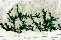
Bhutan Power Corporation Limited
Medium Voltage Points Category: Common
The dataset contains the information about Medium Voltage Network of Whole Bhutan at different Voltage Level i.e. from 33 kV, 11 kV and 6.6 kV.
Keywords: [#pole#electricity#medium voltage#location#power]
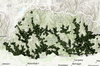
Bhutan Power Corporation Limited
Low Voltage Points Category: Restricted
No descriptions available
Keywords: [#power#electricity#location#pole#low voltage]
Bhutan Telecom
Pole Category: Open
This data provides the location of telephone poles in Thimphu. These poles are typically used to support and string optical fiber cables for telecommunications.
Keywords: [#pole#location#communication]
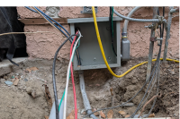
Bhutan Telecom
Jointbox Information Category: Open
The joint box data provides information and location of joint boxes in Thimphu. These boxes are typically used for laying fiber optic cables. They are strategically placed in urban areas to facilitate maintenance work and ensure a clean, organized environment.
Keywords: [#jointbox#location]
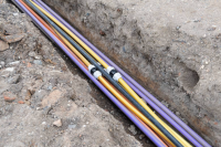
Bhutan Telecom
Optic Fiber cable Category: Open
The Optical Fiber Cable Data provides technical information regarding the layout and specifications of fiber optic infrastructure. This includes precise cable routes, capacity, and network planning, infrastructure development, maintenance, and operational management. The data was collected using GPS devices such as Garmin and Trimble, ensuring reliable and location-accurate mapping of the cable network.
Keywords: [#optic#fiber#cable]

National Land Commission Secretariat
Road Network of Bhutan Category: Open
The road dataset includes Access Roads, Dzongkhag Highways, Primary Highways, Secondary Highways, and Thromde Roads. These classifications are based on their functional hierarchy and administrative importance. The dataset was developed under the coordinate framework of CGI during the National Cadastral Resurvey Program (NCRP). Some portions were updated through digitizing using Google imagery, and topological corrections were applied to address overlaps with the National Highway. Topological corrections were made, especially to ensure proper alignment and eliminate overlaps with the National Highway. This dataset will be updated periodically, and the latest version will be uploaded when updated data is received from MoIT.
Keywords: [#road#access road#highway#dzongkhag road#farm road]
Department of Surface Transport
Bridges Category: Common
The Department of Surface Transport, under the Ministry of Infrastructure and Transport, is responsible for the design, construction, and management of national roads. In recent years, the department has focused on addressing road disaster and risk issues. This has led to the collection and management of geospatial data for inventory, risk reduction, and resilience planning. The department now has comprehensive data on national highways, roads, and bridges, including information on slope failure locations. Additionally, a bridge management database has been established to maintain bridge inventory and related information, facilitating the planning, mitigation, and prioritization of maintenance interventions.
Keywords: [#Transportation#Bridge]


Phuentsholing Thromde
Fire Hydrant No category asigned
This dataset contains the point locations of all fire hydrants within the jurisdiction of Phuentsholing Thromde.
Keywords: [#member agency#phuentsholing thromde#fire hydrant]

Department of Local Governance & Disaster Management
VHF Repeater stations Category: Common
The VHF repeater station locations are maintained and shared with relevant agencies to support emergency communication. These repeater stations facilitate communication when conventional communication channels fail during disasters.
Keywords: [#VHF#Communication]